Entry Points:

About Kern County
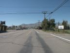
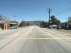
Kern County occupies 8,161 square miles in central southern California. (That is four times the size of Delaware). The southern tip of the Sierra Nevadas extend into the central part of the county, and smaller mountains extend southward, dividing the county in two. The southern end of San Joaquin Valley lies to the west, home to Bakersfield (the county seat) and the main populated areas. Indian Wells Valley, Fremont Valley and Antelope Valley lie on the eastern side.
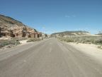
The Mojave Desert covers the eastern parts of the county, with creosote bush and saltbush dominating the scenery. Joshua trees and cholla cactus can be found in some areas. Lake Isabella lies in the Sierra Nevadas, a recreational retreat. The San Joaquin Valley is a farming area.
Kern County's population is 661,645, as of the year 2000. U.S. Highway 395 is the main north-south route along the eastern part of the county, and Interstate 5 and California Highway 99 serve the San Joaquin Valley.