Entry Points:

About Susanville
Susanville lies at the foot of forested mountains at the edge of Honey Lake Valley. The Cascade mountain range, which extend northward through Oregon and Washington, reaches southward to Lassen Peak and other mountains northwest of Susanville. The Sierra Nevadas, which stretch far into southern California, come to an end somewhere south of Susanville. The deserts of Nevada lie to the east, and Honey Lake, although fed by the Susan River and other mountain creeks, is dry.
Peter Lassen prospected in the Honey Lake area in the 1850's and was about the first settler in the area. Lassen County was named after him. In 1851 William Nobles pioneered a trail through Susanville for settlers heading into the Sacramento Valley, which became knows as the Nobles Emigrant Trail. Isaac Roop established a trading post at Susanville to supply the settlers for their journey through the mountains. At first called Roopville, the town which sprouted up at the trading post was later named Susanville, after Roop's daughter.
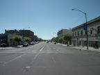
U. S. Highway 395 barely misses Susanville passing to the east to skirt the mountains. California Highway 36 follows Main Street through Susanville and follows the Nobles Trail into the mountains. As of the year 2000, Susanville was home to 17,023 people. The elevation ranges from about 4150 feet in the valley, to about 4,500 feet up the side of the mountain.
Street Index
|
Cottage Street Gay Street Lassen Street Main Street Maple Street |
Nevada Street North Street Parkdale Street Pine Street Prattville Road |
Quarry Street Roop Street State Highway 36 Union Street Weatherlow Street |